Treaties
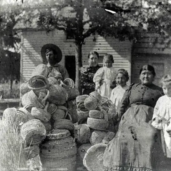
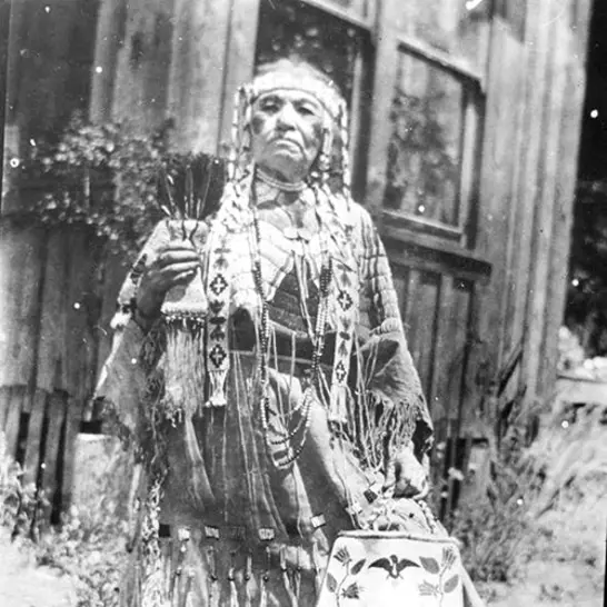
Since time immemorial tribal people have relied on the traditional landscapes of western Oregon, northern California, and southwest Washington for their livelihood. The fish and game were plentiful and what the lands didn’t provide, they acquired by trade.
This way of life changed with western expansion. Ratified and unratified treaties between the Tribes and the United States Government from 1853 through 1855 resulted in the forced removal of tribal members from their ancestral homelands. Despite this removal, tribal members maintained their connection to their homelands and areas such as Willamette Falls and Table Rocks.
Historical Treaties
As the western expansion of the mid-19th century encroached on the traditional lands of the Confederated Tribes of Grand Ronde, treaties became the mechanism for agreements between the Tribes and the U.S. Federal Government. The established treaties resulted in the recognition of Tribes as sovereign nations. This recognition still exists today. Approximately 800 treaties were signed between Native Americans and non-Native American nationals by 1871. Over 500 of these treaties have been signed
with the United States.
Ratified and unratified treaties between the Tribes and the United States Government from 1853 through 1855 resulted in the forced removal of tribal members from their ancestral homelands. Despite this removal, tribal members maintained their connection to their homelands and areas such as Willamette Falls and Table Rocks.
We understand fully what you mean and that it may be better for us, but our minds are made up.” Placing his finger on the place on the map which designated the fork in the Santiam River, he said “We wish to reserve this piece of land. We do not wish to leave this. We would rather be shot on it than be removed.
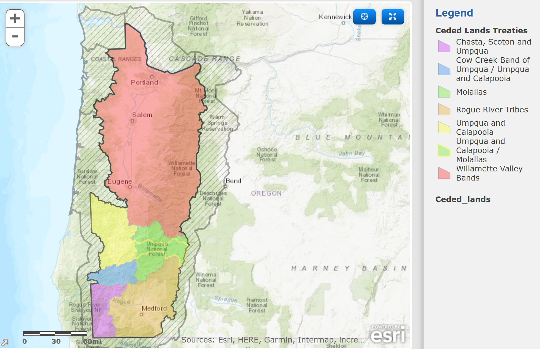
Between 1853 and 1855 seven new treaties were negotiated and signed by Tribes in western Oregon and ratified by Congress ceding their title to the land from the Coast Range to the Cascade Range and relocating them to a future but as yet unestablished Reservation.
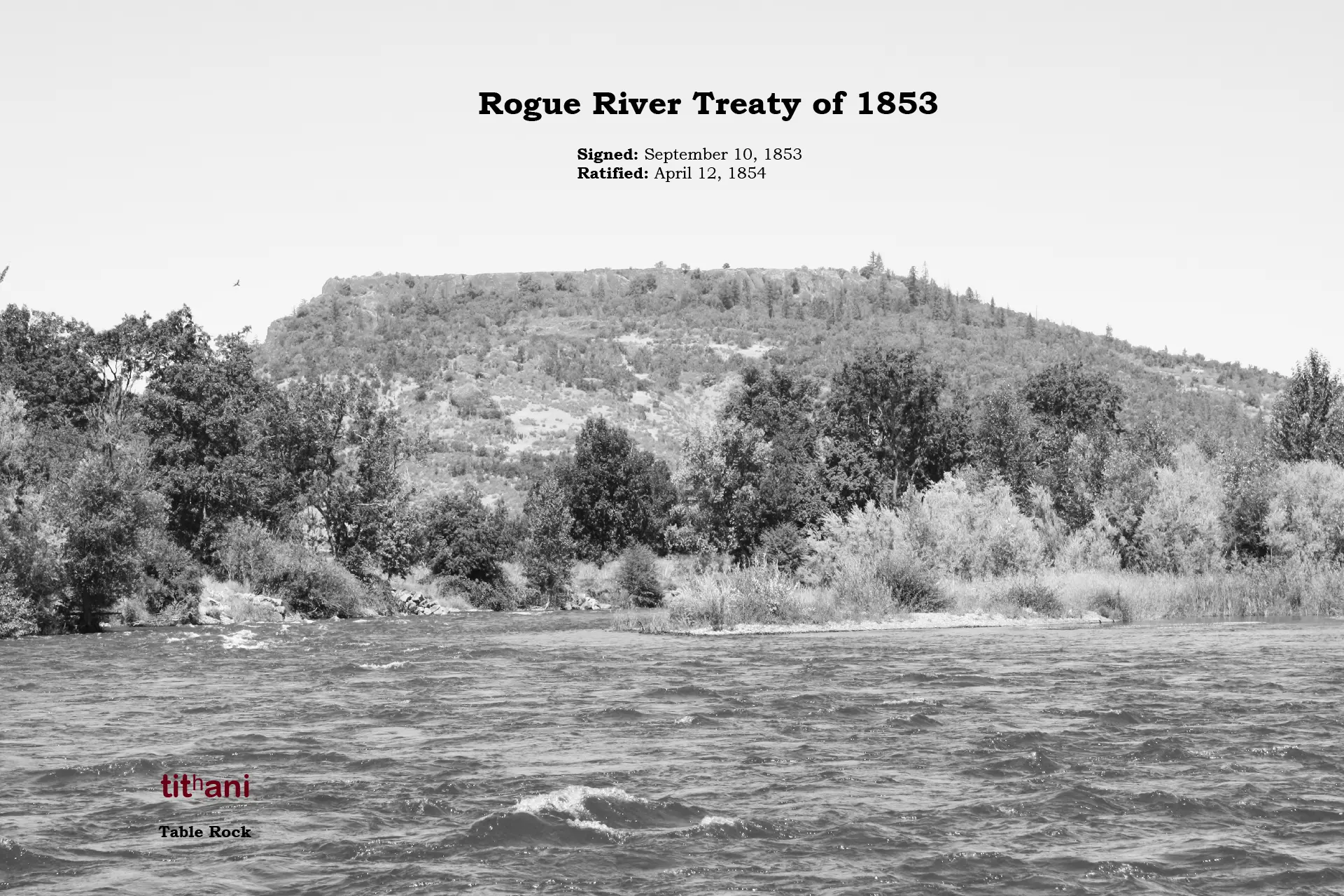
Rogue River Treaty of 1853
Signed: September 10, 1853
Ratified: April 12, 1854
Tribes and Bands: Takelma, Upper Takelma, Latgawa, Shasta, Applegate, Galice
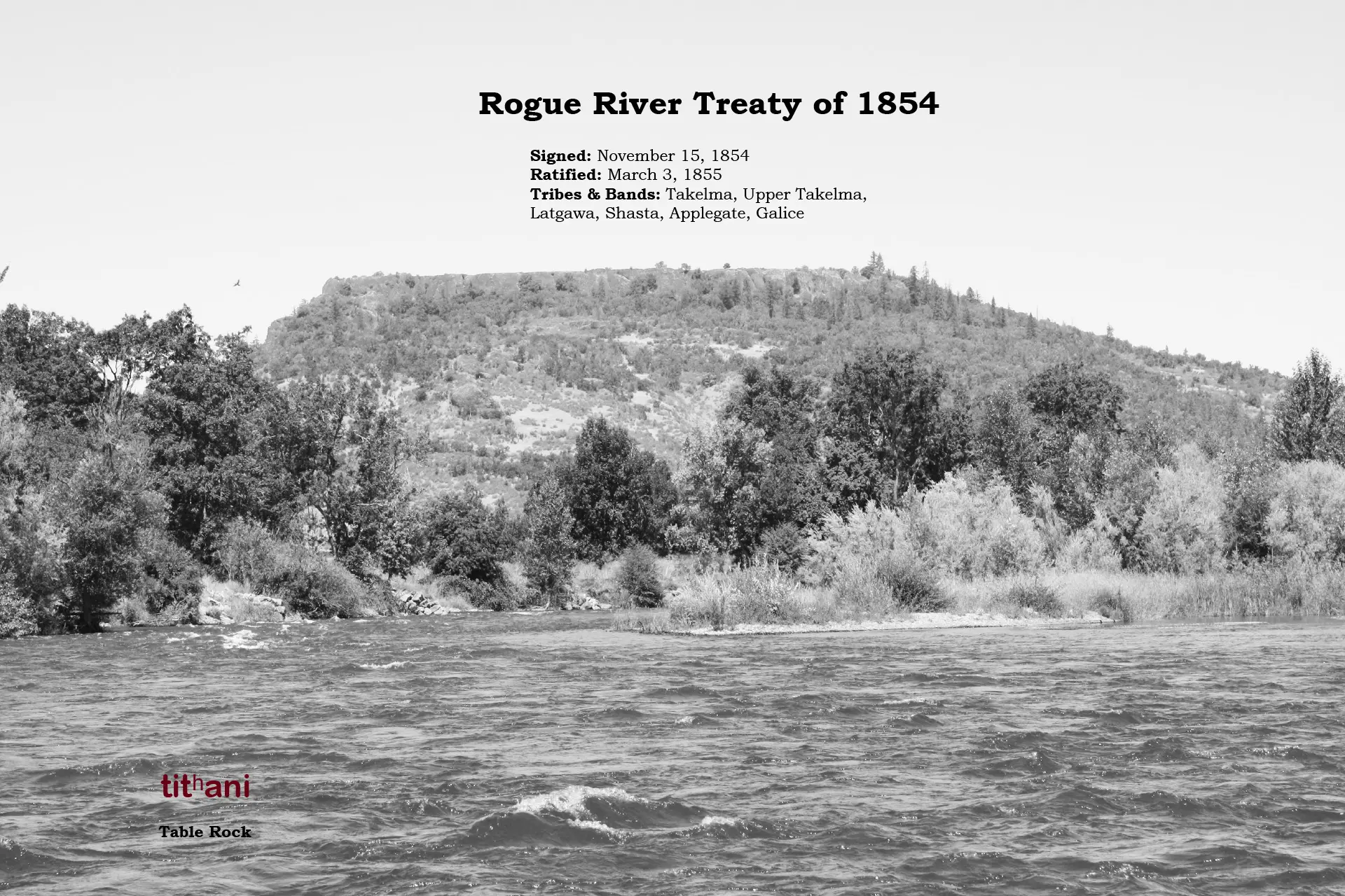
Rogue River Treaty of 1854
Signed: November 15, 1854
Ratified: March 3, 1855
Tribes and Bands: Takelma, Upper Takelma, Latgawa, Shasta, Applegate, Galice
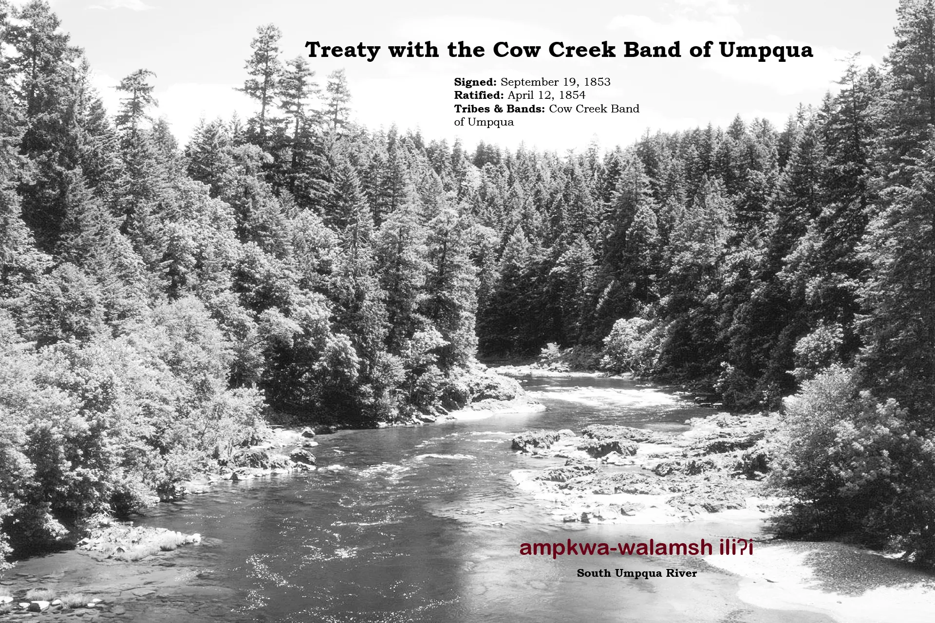
Treaty with the Cow Creek Band of Umpqua
Signed: September 19, 1853
Ratified: April 12, 1854
Tribes and Bands: Cow Creek Band of Umpqua
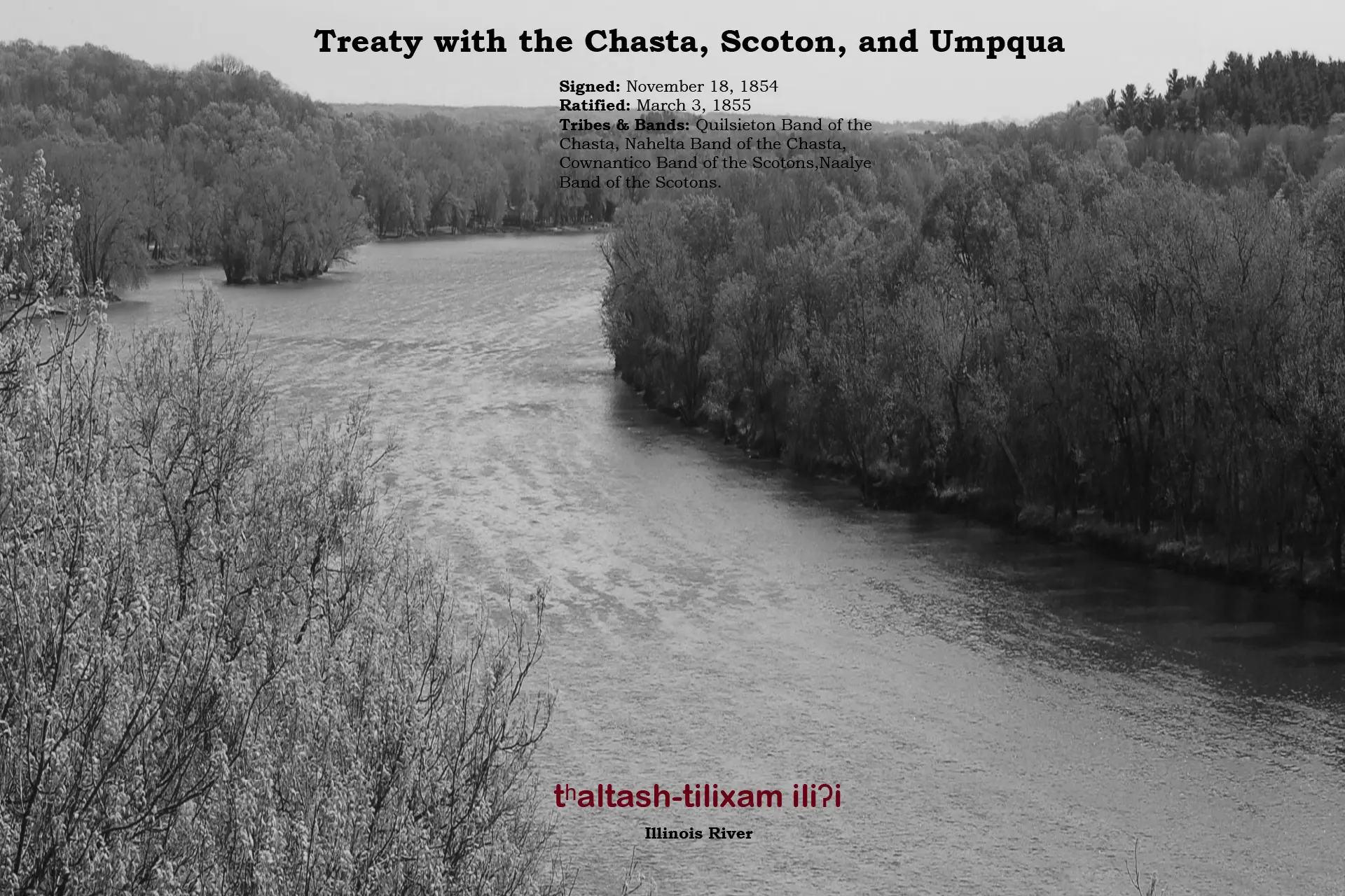
Treaty with the Chasta, Scoton, and Umpqua
Signed: November 18, 1854
Ratified: March 3, 1855
Tribes and Bands: Quilsieton Band of the Chasta, Nahelta Band of the Chasta, Cownantico Band of the Scotons, Sacheriton Band of the Scotons, Naalye Band of the Scotons.
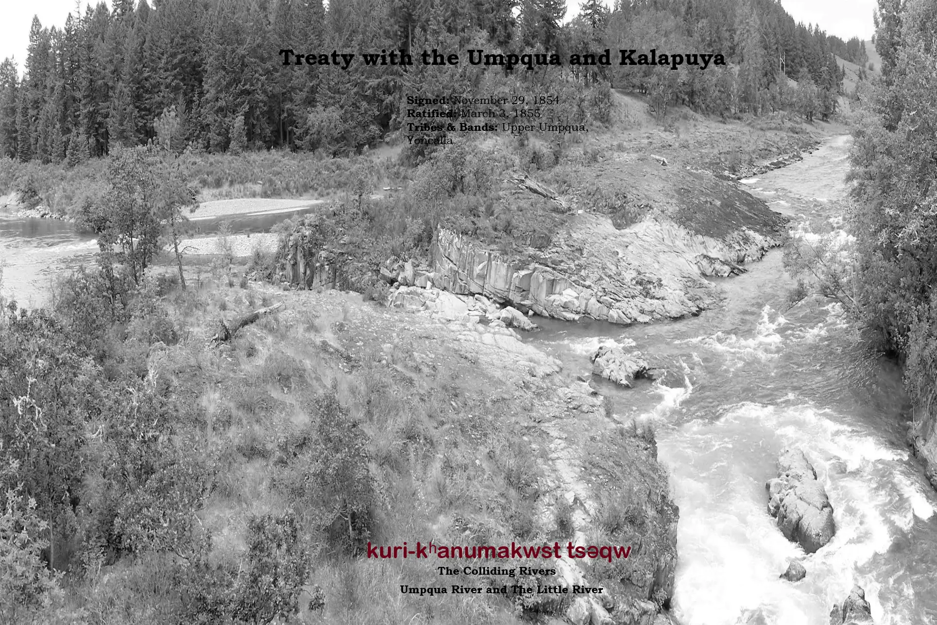
Treaty with the Umpqua and Kalapuya
Signed: November 29, 1854
Ratified: March 3, 1855
Tribes and Bands: Upper Umpqua, Yoncalla
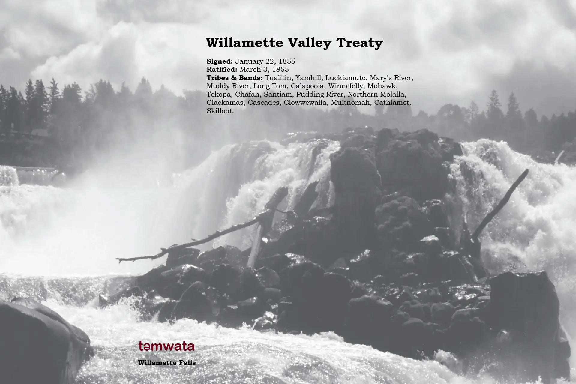
Willamette Valley Treaty
Signed: January 22, 1855
Ratified: March 3, 1855
Tribes and Bands: Tualatin, Yamhill, Luckiamute, Mary’s River, Muddy River, Long Tom, Calapooia, Winnefelly, Mohawk, Tekopa, Chafan, Santiam, Pudding River, Northern Molalla, Clackamas, Cascades, Clowwewalla, Multnomah, Cathlamet, Skilloot.
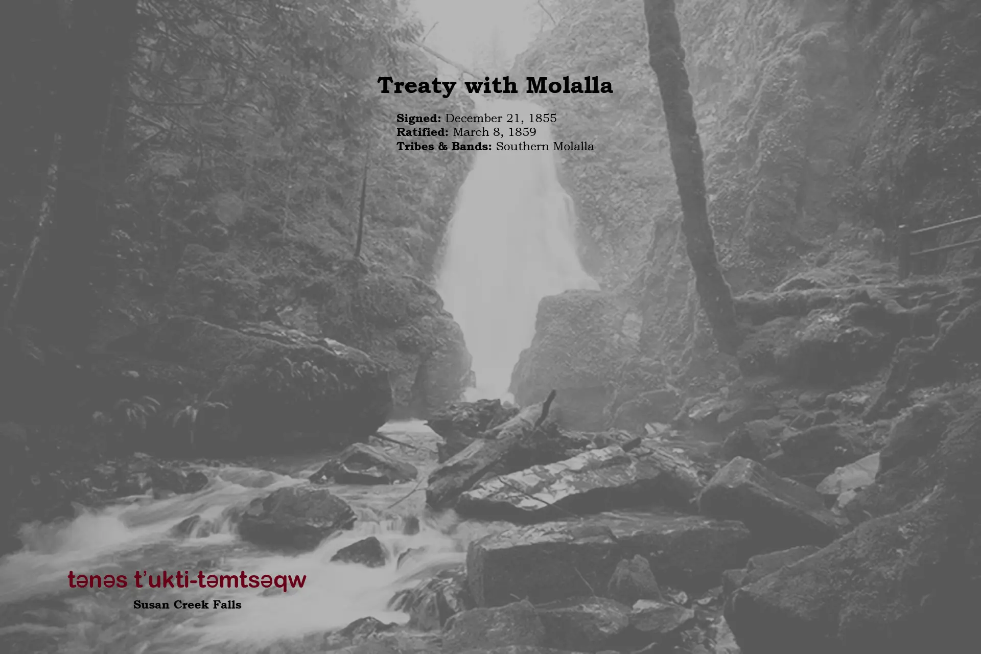
Treaty with the Molalla
Signed: December 21, 1855
Ratified: March 8, 1859
Tribes and Bands: Southern Molalla
The Grand Ronde Reservation was established by Executive Order on June 30, 1857. Originally 61,000 acres, it was located on the headwaters of the South Yamhill River in the Oregon Coast Range. Federal actions in the late 1800s quickly decreased the Grand Ronde Reservation land-base.
The General Allotment Act of 1887 was designed to transition tribal members into farmers. Under this act, the government divided the Grand Ronde Reservation into 270 allotments for individual tribal members, totaling slightly more than 33,000 acres. This act also allowed tribal allotment lands to go from federal trust status to private ownership after 25 years. This resulted in major portions of the Reservation being lost to non-Native ownership. Then, in 1901, U.S. Inspector James McLaughlin declared a 25,791-acre tract of the Grand Ronde Reservation “surplus” and the U.S. sold those “surplus” lands for $1.16 per acre.
More from our History